
48-Hour Da Nang Mountains Itinerary: Clouds Over Dinh Que Peak and a River in Hoa Bac
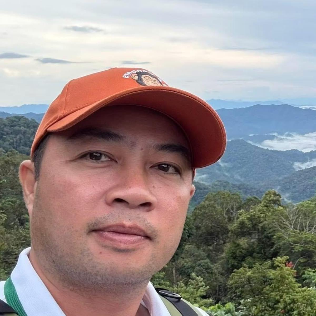
Clouds over Dinh Que Peak, a river in Hoa Bac, and the feeling of being a child again
I was born in Da Nang, and I work for a travel company, where I look after Vietnam visas.
My job means I talk to foreign travellers all the time, and most of them ask about the same places: My Khe Beach, the Dragon Bridge, Hoi An’s Old Town.
Those places really are beautiful.
But having grown up here, I know my city has another face, quieter and wilder, that very few visitors ever get to see.
Thama is a friend of mine, a financial consultant from Singapore.
On her first visit, in 2024, she spent five days between central Da Nang and Hoi An.
She fell in love with swimming in Da Nang’s sea, with the street snacks of Hoi An’s Old Town, and with the people here.
So when she decided to come back, I made her a promise: this time, I would show her a very different Da Nang, the quiet side of this famously liveable city.
Since mid-2025, when Quang Nam province merged into Da Nang, my city has stretched all the way from the coast to the Truong Son mountains.
To keep my promise, I didn’t need to take Thama far.
All we had to do was turn our backs on the sea and head for the mountains.
48-Hour Da Nang Mountains Itinerary at a Glance
Here’s the complete 48-hour itinerary at a glance, inland rather than on the coast.
Day one rides 100 kilometres west into the Truong Son mountains. Day two starts above the clouds and ends in a tent by the river in Hoa Bac.
Day 1: Into the Truong Son Mountains
- Morning: Land at Da Nang airport and ride straight west on Highway 14G
- Lunch: A bowl of mì Quảng halfway up the road
- Afternoon: Mountain passes, waterfalls, suspension bridges and Co Tu villages
- Evening: Loc Troi homestay, a fire, grilled chicken and rice wine from the jar
Day 2: Clouds, Then a River
- 7am: Dinh Que Peak at about 1,400 metres, clouds in the valleys, around 15°C
- Midday: Ride down and follow the Cu De River to Hoa Bac
- Afternoon: Fishing, picking corn, grilled fish and cơm lam at roadside eateries
- Night: A tent at Lang Me campsite in the Hoa Bac meadows
Day one: 100 kilometres into the mountains
Thama’s plane landed at Da Nang airport at 9am. We didn’t stop at a hotel.
We got on a motorbike and rode straight west, towards Dinh Que Peak, about 100 kilometres from the city centre.

The city quickly fell away behind us.
Highway 14G began to twist and turn, and then came one winding mountain pass after another, each bend leading straight into the next.
Green forest rolled on in every direction, and every now and then a waterfall appeared, tumbling down the mountainside.
We crossed suspension bridges strung over rivers and streams, and passed villages of the Co Tu people deep in the forest.

Halfway, we stopped for lunch: a bowl of mì Quảng, the noodle dish that tastes most like home to me.
The whole ride took about three hours. The road winds endlessly, but it is so beautiful that nobody wants to hurry.
Our first night was at Loc Troi, a homestay run by Alang.
After dark we lit a fire, grilled chicken and drank rice wine with our host.

Out there in the mountains there was no sound of traffic, only the firelight, the smell of grilled chicken and the earthy taste of the highlanders’ rượu cần.
This rice wine is fermented in large jars, and everyone sits around the jar and drinks from it together through long bamboo straws.
Day two, 7am: above a sea of clouds
The next morning we went up Dinh Que.
At about 1,400 metres, high in the Truong Son range, the peak is wrapped in cloud for most of the year, and many people call it “the little Sa Pa of Quang Nam”.
At 7am the temperature was only about 15°C, a rare kind of cold for someone from Singapore.

In front of us, clouds flowed through the valleys, and layer upon layer of forested mountains appeared and disappeared behind them.
We had no plan at all.

We just wandered, watched the clouds, the mountains and the wildflowers, and ate a steaming bowl of instant noodles in the cold mountain morning.

In just one day, Thama had seen the simple life of Da Nang’s mountain people, breathed the clean forest air and eaten food cooked the way the highlanders cook it.
She said to me: “I feel like I’ve arrived in another world, a perfect world.”
Afternoon, day two: following the river down to Hoa Bac
From Dinh Que I took Thama to Hoa Bac, in the north-west of the city.
The road follows the Cu De River, long, winding and calm, which rises in the Truong Son mountains and meets the sea at Nam O.

On both banks, rice fields and lush green meadows stretch out as far as you can see.
It stays cool here all year round, and life moves slowly.
That afternoon in Hoa Bac, we lived like farmers: fishing on the riverbank, picking corn to grill, and picking fruit.

Every meal we ate was at a small roadside eatery, cooked by local people: grilled fish, cơm lam, sticky rice, grilled chicken.
Cơm lam is sticky rice packed into a bamboo tube and cooked over a fire; when it is done, the bamboo is split open to reveal a soft, fragrant log of rice that smells of bamboo.
Nothing fancy, nothing luxurious, but warm and simple.

On our second night we slept in a tent at Lang Me, a campsite in the middle of the Hoa Bac meadows, beside a cool stream.
When night fell, there was only the sound of the stream and a wide-open sky above us.

Like being a child again
It was a very different Da Nang. No crowded beaches, no Old Town glowing with lanterns.
Only clouds, mountains, rivers, meadows and kind, gentle people.
A Da Nang that is soft and poetic, one that takes you back to your childhood.

The next morning, as we said goodbye, Thama told me: “I will come back. I will come back to this world.”
The first time, Thama came to Da Nang for the sea.
This time, she took home to Singapore the clouds of Dinh Que, the river of Hoa Bac and the taste of roadside cơm lam.
As for me, I knew I had kept my promise.
If you want to go
- When to go: The clouds on Dinh Que are thickest from October to February, best early in the morning, and usually clear by around 9–10am. But October to December is the rainy and storm season in central Vietnam, when the passes are slippery and the fog is thick; January and February usually still have clouds, with less rain. Camping in Hoa Bac is best in the dry season, roughly March to September.
- Getting there: Dinh Que is about 100 km from Da Nang airport, around three hours by motorbike along Highway 14G, via the Doc Ken pass and the town of Prao. The mountain roads have many sharp bends; if you are not used to riding a motorbike in the mountains, go with a local or hire a car with a driver. Hoa Bac is only about an hour from the city centre.
- Suggested plan: Day 1: land in the morning, ride up into the mountains and sleep at a homestay near Dinh Que. Day 2: get up early for the clouds at 7am, ride down at midday, spend the afternoon fishing and picking corn in Hoa Bac, and sleep in a tent by the stream. Day 3: head back to the city centre in the morning.
- Where to stay: Near Dinh Que there are homestays run by local families, such as Loc Troi; book ahead. In Hoa Bac there are campsites such as Lang Me, with overnight tent packages.
- What to eat: mì Quảng on the way; grilled chicken, cơm lam and rice wine in the mountains; grilled fish, grilled corn and seasonal fruit in Hoa Bac. The roadside eateries are simple, but the food is cooked by local people.
- What to bring: a warm jacket (at 7am on the peak it is only about 15°C), a raincoat, shoes with good grip, insect repellent, and cash for the roadside eateries.
- Be respectful: ask before photographing people in the villages, and take your rubbish back to the city with you.
- Visas: Singaporean citizens can stay in Vietnam visa-free for up to 30 days. Most other visitors need an e-Visa before they travel; apply at least a week before your flight.
By Duong Thanh Nha
More Universal Traveller Guides to Vietnam
- The Pullman Danang Beach Resort, Da Nang
- Namia River Retreat, Hoi An
- An Epic Evening in Halong Bay
- The Anam Cam Ranh, Nha Trang
- Pandanus Resort & Spa, Mui Ne
- About the Author
- More info
Duong Thanh Nha was born and raised in Da Nang, Vietnam, and is the director of Thai Viet Tourism, a licensed international tour operator in the city that helps travellers with Vietnam e-Visas and airport fast track.